Route Description
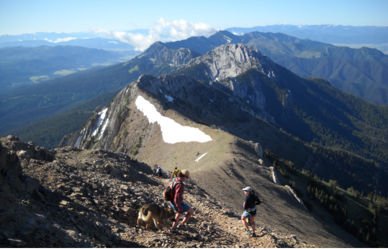
The route embarks from Fairy Lake parking area (elevation 7,600'), which is forested. From there it follows a clearly defined trail that steeply climbs well above tree line into a granite basin to gain a pass, then to Sacagawea peak (elevation 9,650') at which there is a minimal Aid Station with water only. The route continues along a vague trail to Naya Nuki peak, then down a steep loose shoot to gain the Foothills Trail. The route then follows the Foothills trail South-bound to Ross Pass (elevation 7,650') where there is an Aid Station and medical team. The route then follows a vague trail that steeply ascends along the Bridger ridge. The route continues to be rocky, sometimes braided difficult to follow precisely, and sometimes exposed, to the top of Bridger ski lift (elevation 8,500') where there is an Aid Station and a medical team. This nature of the route continues along the ridge up Saddle peak (elevation 9,150'). After Saddle peak, the route becomes less technical as it rolls along the ridge to Baldy Mountain (elevation 8,900') where some limestone blocks require a bit of scrambling. Then the route becomes smooth to Baldy peak (elevation 8,680'), where there is an Aid Station and medical team. The route then follows a clearly defined trail that steeply descends to a brief respite of descent (elevation 7,100') where there is a minimal Aid Station. The route continues steeply descending to the M parking area. From the M parking area, participants are directed through the Drinking Horse tunnel, to the Finish Line at the Fish Hatchery (elevation 4,900').
We impose the following cut-off times. Any participant who arrives at one of these spots after its accompanying cut-off time is automatically disqualified, and can join the volunteers' transit back to the Finish Area.
- Sacagawea -- 8:05am
- Ross Pass -- 9:40am
- Bridger -- 11:05am
- Finish -- 2:30pm.
If a participant drops out of the race, it is imperative that they do so at an Aid Station and that they clearly notify the Aid Station Lead. (If a participant is unaccounted for, we assume the worst and we commence an open search for them across the Bridger mountain range.)
Bridger Assistant
AIYou are about to initiate a chat with an AI assistant (not a person).
By clicking “Agree and start chatting”, you agree to the collection, recording, storage and processing of this chat communication as outlined in our Privacy Policy.