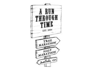
Half Marathon Race Course Description and Maps

2026 Run Through Time Half Marathon Course Information - this is the same course as 2025
- 10 miles of narrow hilly single track trail, with the remainder on dirt/jeep roads
- Approximately 1800 feet of climbing. Low point 7000’, High point 7866’
- 5 hour time limit
- 2 aid stations, 1 of which will be accessed 2 times (miles 3.4, 6.1, 11.5)
- Participant limit: 250
- This is a new course for 2025. Distance is 13.2 miles
Our starting line will be on CR 177, which is the road north of the railroad tracks at the base of S Mountain. Course will head northwest along 177 and then turns right and uphill to a water tank. Turn left at the water tank to CR 175, turn left to CR 177 or the road north of the railroad tracks, and head back to the starting line. This section of the course is nice packed dirt roads and paved highway with little elevation gain. Take advantage of this to space out before the single track.
Runners will then head east around the new bike skills park to connect to the Frontside trail. Runners head up the Frontside Trail to the Spiral Drive road and kiosk, where the first aid station of the race will be located (mile 3.4). Runners will then head downhill on Spiral Drive to the Rusty Lung intersection and take a right to head up the Rusty Lung Trail to CR 173. Turn left and head uphill on CR 173 before taking an almost immediate left onto the North Backbone trail. Follow this trail for just over a mile before turning right onto the Dudes Abides trail. Follow Dude Abides until it terminates at CR 173. This location is where the marathon runners will rejoin the half marathon course - please pay attention to runners coming up behind you.
Runners then head downhill for a very short stretch on CR 173 to reach the 2nd aid station at the CR 173/Sand Dunes intersection (mile 6.1). Turn left onto the Upper Sand Dunes Trail. This next stretch of the course is fairly technical - watch your footing. Head downhill on Sand Dunes for .7 miles, and then turn left to head uphill again on the Prospector trail. This stretch of trail can be muddy - remember to run through any muddy sections and not around. Turn right to head down the very end of the Uncle Nazty trail, and then turn right to head down the Cottonwood trail. Runners follow the Cottonwood trail to its intersection with the Backbone trail and continue to follow the Backbone trail. Follow the Backbone trail until you reach the Tenderfoot trail, and veer left to follow the Tenderfoot trail. Follow Tenderfoot all the way to the Spiral Drive road.
Runners will then head up to the top of the Spiral Drive road - a local favorite! Stay on the left hand side the entire time you’re on Spiral Drive, following the road around the small building up top and heading downhill to the Lil Rattler trail. Head onto Lil Rattler to the Spiral Drive kiosk and your first and now last aid station at mile 11.5.
Head back down the Frontside trail, following it all the way out to the dirt road. Turn right and then follow the course markings to cross the railroad tracks at the at grade crossing; follow the road west to the parking lot, cross the F Street Bridge and turn left into Riverside Park. Follow the path east through Riverside Park back to the finish near the Salida Scout Hut. Congratulations, you have finished!
Click Here for Online Map


