Front Ranch Lollipop - 5k
This course is available for running and walking.
* All courses are subject to route changes. Any changes will be clearly marked by trail flagging.
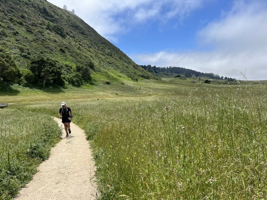
Looking for a fast and fun trail run/walk? This is the option for you! This 5k 'lollipop' course is relatively flat, with just enough elevation change to get your heart pumping and your feet happy!
Our 5k course Start/Finish is at Palo Corona Regional Park Discovery Center, where restrooms and an aid station are available. Runners will follow well-tended trails through Palo Corona's Rancho Cañada, across the Carmel River, and along the much-loved Southbank Trail before entering the Palo Corona Regional Park front ranch (note that dogs are not permitted beyond the Southbank trail). From here, a gentle uphill takes runners to the foot of Inspiration Point (a portalet is available here), as they wrap through the front ranch on its wide and welcoming fire roads. Halfway through the course 'lollipop', runners/walkers are treated to a beautiful view of Big Sur Land Trust's Carmel River Floodplain Restoration and Environmental Enhancement (CR FREE) project site, and the ocean beyond, before completing the lollipop and continuing along familiar trail back to the Start/Finish.
Participants should carry any aid (i.e., water and snacks) they might need while on the course, although a limited-supply aid station will be offered at the Start/Finish. Please note that the Race Team may elect to alter the course or limit the participation of individuals should safety concerns arise due to weather or otherwise.
About Palo Corona Regional Park
Palo Corona Regional Park is one of the Central Coast’s most significant undeveloped open spaces. In the largest land conservation project in Monterey County history, Big Sur Land Trust, the State of California, Monterey Peninsula Regional Park District (MPRPD), and The Nature Conservancy partnered to acquire the 10,000-acre Palo Corona Ranch. The acquisition was finalized in 2004. The 10,000-acre ranch was then divided between the California Department of Fish and Wildlife (CDFW) and MPRPD to be protected in perpetuity. MPRPD created the new Palo Corona Regional Park with the northern 4,350 acres of the former ranch. In 2018, in partnership with The Trust for Public Land, California Wildlife Conservation Board, CDFW, California State Coastal Conservancy, California Natural Resources Agency and Santa Lucia Conservancy, an additional 190 acres of the former Rancho Cañada Golf Course was added to the park.
Beginning at near sea level and rising to over 3,400 feet in elevation, Palo Corona is home to over 500 species of plants as well as several federally-endangered and threatened species including steelhead trout, California red-legged frog, California tiger salamander, Smith’s blue butterfly, golden eagle, and California condor. Palo Corona also provides habitat connectivity for several previously-protected conservation properties, including Garrapata State Park, Joshua Creek Ecological Preserve, Mitteldorf Preserve, Glen Deven Ranch, Point Lobos State Natural Reserve, Santa Lucia Conservancy lands, and the Ventana Wilderness.
About Southbank Trail
Big Sur Land Trust acquired land and multiple trail easements in Carmel Valley to create the Southbank Trail starting in 2011. Located on the south side of the Carmel River, the trail runs between Rancho San Carlos Road and Palo Corona Regional Park. Southbank Trail is maintained by the Monterey Peninsula Regional Park District in agreement with Big Sur Land Trust.
Big Sur Land Trust conserves and cares for the lands you love throughout Monterey County.
Big Sur Land Trust’s conserved properties include diverse habitats that span rare sensitive dunes in Marina, majestic redwood forests in the Santa Lucia Mountains and in Big Sur, expansive oak woodlands, grasslands, and river corridors form Arroyo Seco to the Gabilan Mountains. And in 2017, we added our first urban site at Carr Lake in Salinas! Curious to learn more? Click here for a visual tour of Big Sur Land Trust's protected lands throughout Monterey County.