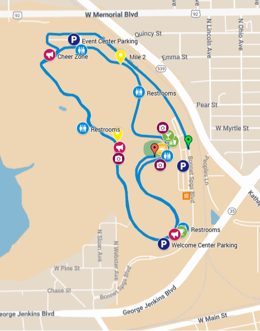
CLICK on the image to go to an interactive Google map to use for driving or walking directions.
The first 0.5 miles of the 5k will be on Bonnet Springs Blvd. The course will transition to the circulator path for 1.5 loops of the path. The path will be split with cones and runners will be directed to the outside (right) lane for loop one, and the inside (left) lane for loop 2. The finish will be at the Family Lawn.
There will be one water stop just past 1.5 miles.
The course is rolling terrain.
See our Maps menu for a course elevation profile and course certification information.